DEP submission to ESC consultation on the commercial hiring of Jet Skis – 25 November 2024

On the 21 October 2024, East Suffolk Council’s Licencing Committee resolved to carry out a
consultation on the licensing of commercial operators of Jet Skis/water scooters. The aim of the consultation was to seek the views of operators, interested parties and the general
public to ensure that all views are taken into consideration by the Licensing Committee in their
decision making. The consultation ran from 29 October to 26 November 2024.

East Suffolk Council invited respondents (including the DEP) to express their views on the following questions:
a. Whether the Council should licence Jet Skis?
b. What conditions if any should be imposed?
c. What minimum specification should be required?
d. Should zones of operations be imposed?
e. Should dates and times of operation be imposed?
f. How should the policy be enforced?
g. Any other comments?

Because the DEP is a partnership of separate organisations with diverse interests in this matter, the Chair sent a note to all members of the DEP Steering Group on 20Nov24 explaining about the consultation and inviting them to submit individual responses from each organisation that reflected their separate views. But because ESC specifically requested a response from the DEP, the Chair would submit a personal response that reflects the many views and opinions that have been shared with him as Chair of the DEP on this matter.

Click here to view a copy of the DEP response submitted to ESC on 25Nov24.
‘Co-Producing Coastal Knowledge: empowering communities through science and action’ – 20 November 2024

Professor Helene Burningham and her team were applying for a grant for this community-based project ‘Co-producing Coastal Knowledge’, and asked the DEP to show its support for this proposal.

The Deben Estuary Partnership (‘DEP’) is delighted to support this important project because we believe it will bring increased emphasis and attention to the valuable community science work that Professor Burningham and her enthusiastic teams of local volunteers have been doing around the Deben estuary.

As we revise and update the existing Estuary Plan, we recognise and appreciate the value that our communities bring to the estuary, both in terms of participatory action but also in data generation and knowledge growth. The DEP has been actively supporting the Deben Marine Centre (where much of our community science data and information is currently gathered and shared) since its opening three years ago, but we are keen to expand this knowledge and understanding to the broader community. In particular, we want to demonstrate how local but long-term measurement and monitoring data can not only be delivered through community projects, but also how an improved understanding of the science can lead to better, more informed decision making.

Click here to read our letter of support

Anglian Water publishes its Water Resources Management Plan – 26 September 2024

Anglian Water have now published a new Water Resources Management Plan (WRMP24), which sets out their plans for dealing with population growth, climate change, and environmental improvement. Their main areas of focus are:

  • Demand Management (facilitated by smart metering)
  • New raw water reservoirs (one in the Fens and another in Lincolnshire) – which they say may also provide other benefits for nature and leisure
  • Increased use of other sources of water, such as water reuse, desalination and transfers

Here are links to the main report and a non-technical summary:

New Report ‘Bawdsey Beach Monitoring – Coastal Trends’ published – 30 August 2024

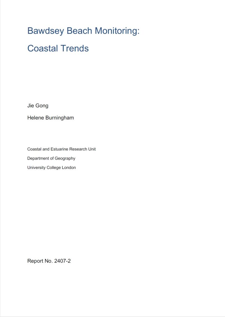
Jie Gong and Helene Burningham today published their report and analysis of the data from the voluntary, community-based Bawdsey Beach Monitoring (BBM) activity that has been taking place regularly since 2013. Detailed, weekly measurements enable an enhanced analysis of beach dynamics and the processes and conditions that drive change along our shoreline.

The report demonstrates that the BBM data aligns well with national monitoring data, but that the higher temporal frequency of the BBM data means that it is more effective at capturing beach behaviour over a range of timescales from weeks to months and years.

Key findings from the data collected so far include:

  1. Overall beach volume has declined over the years – any episodic sediment influx during winters is short-lived.
  2. Bawdsey Beach is influenced by a bidirectional wave climate split between north-easterly and southerly waves – north-easterly waves (mostly in the summer) tend to drive erosion and southerly waves (mostly in the winter) lead to accretion.
  3. Sediment movement is cyclical – sediment accretion in the south and erosion in the north occurs during winter, but during summer the pattern is reversed – accretion in the north and erosion in the south.
  4. Sediment transport along the Deben inlet is unidirectional (into the estuary), and elevation changes here are linked to the dynamics of Bawdsey spit that supplies the inlet with sediment in the form of banks that periodically more alongshore.
  5. The reduction in open beach volume is linked to: i) sheet piling coastal defence structures that prevent movement of the shoreline, ii) limited gravel contained in the eroding cliffs to the north, iii) separation of the Bawdsey sediment system from the Orford Spit/Shingle Street sediment system due to the coastal defence structures at East Lane, and iv) degraded groynes that locally modify beach sediment storage. The overarching decline in sediment supply to this shoreline threatens the Deben estuary mouth, potentially reducing the protective function of The Knolls and future sediment supply to the Felixstowe Ferry shoreline.

EA examine weeds and algae on intertidal mud in Woodbridge – 12 August 2024

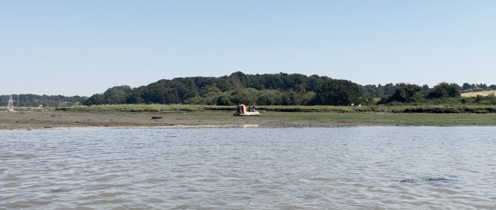
Local residents and water users were surprised to see a hovercraft travelling up and down the Deben, and then stopping on the mud flats to take samples and measurements. When asked what they were doing, the operators explained that they were studying the weeds and algae on the mud as an indicator of the long term water quality.

When asked for more detail, Naomi Boyle of the Environment Agency said: “This was our planned Deben Estuary opportunistic macroalgae sampling as part of our TraC programme  (Transitional and Coastal Waterbodies), and as part of a larger programme of work focussed on the Deben this year.

Note: Use of hovercraft is limited to window after bird breeding season and before wading bird passage season, we have to get agreement from Natural England. We use a contractor pilot who is highly experienced in this survey method.”

Mystery solved!

EA publishes new guidance for riparian landowners – 16 July 2024

The Environment Agency has published new guidance for ‘main river’ Riparian landowners – ‘main rivers’ differ from other watercourses in that the EA is responsible for maintenance, improvement or construction work on ‘main rivers’ to manage flood defence, whereas lead local flood authorities, district councils and internal drainage boards carry out flood risk management work on ‘ordinary watercourses’.

The Deben is classed as a ‘main river’ for most of its length – the Statutory Main River Map shows all ‘main rivers’ in dark blue, and other watercourses in turquoise.

Secretary of State approves Felixstowe Ferry – Bawdsey Coastal Footpath route – 5 May 2024

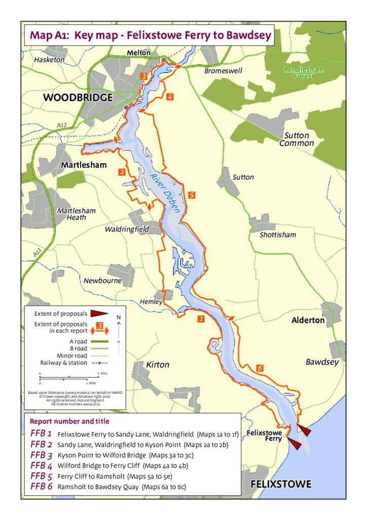
On 5 May 2023 the Secretary of State for Environment, Food and Rural Affairs announced their decision to approve the Natural England (‘NE’) proposals for lengths FFB2 (Sandy Lane, Waldringfield to Kyson Point) and FFB3 (Kyson Point to Wilford Bridge).

Twelve months later (on 3 May 2024) they announced their decision to approve the NE proposals for lengths FFB1 (Felixstowe Ferry up river to Sandy Lane, Waldringfield), FFB4 (Wilford Bridge to Ferry Cliff), FFB5 (Ferry Cliff to Ramsholt) and FFB6 (Ramsholt to Bawdsey Quay).

https://www.gov.uk/government/publications/coastal-access-section-52-notice-for-felixstowe-ferry-to-bawdsey

DEFRA points out that “The right of access to the approved stretch of coast does not come into effect at this stage. Natural England will be working with the local authority to establish any infrastructure works before an Order is made by the Secretary of State under the 2009 Act to bring the rights into effect.”

EA ‘looking for sites to plant riverside trees’ – 30 April 2024

The Environment Agency today issued an invitation to local landowners and community organisations that could be of benefit to the River Deben. They say:

Tree planting along Rivers in Suffolk & north Essex 2024-5
We have some funding for native tree planting along rivers in Suffolk (including parts of Essex within
the River Stour catchment) for 2024-5 and wish to target those lengths of rivers which are likely to
benefit from additional trees and/or scrub.
Planting native tree species along a river can a significant improve water quality through stabilising
the riverbank and reducing sedimentation. Trees also provide much needed shade which helps to
keep rivers cool and improve the habitat for fish and terrestrial wildlife. Shading also helps to control
the growth of excessive emergent vegetation which can choke the channel slowing the flow and
causing siltation.
If you are interested, we would like to walk your stretch of river and discuss options with you. If
appropriate we will come up with some sympathetic planting proposals for your approval. The
funding will cover the material cost of trees and protection and planting costs. The timescales for
planting will need to be between November 2024 and March 2025 so we would aim to walk each
site and draw up any plans during summer and early autumn 2024.

Please click on this link to see the full invitation and contact details

EA analysis shows only one instance of poor water quality at Waldringfield – 14 February 2024

At the East Suffolk Catchment Plan (ESCP) workshop organised by the Essex and Suffolk Rivers Trust (ESRT) on 08Feb24, Alison Parnell of the Environment Agency was asked about the outcome of EA’s regular water testing programme at Waldringfield (now that it has Bathing Water status). She explained that the water quality data is gathered regularly, uploaded frequently and is publicly available online. The EA has also prepared a simple handout explaining how to access and interpret the data.

The Bathing Water Regulations 2013 set out the bathing water ‘season’, which runs from 15 May to 30 September each year. The EA is required to test for two types of bacteria, and Waldringfield is sampled twenty times a season. At the workshop, she outlined the results of water testing in 2023, and she subsequently emailed us the EA report on Waldringfield Water Quality .

The report states that an Environment Agency sample taken on 2nd September was high in bacteria, both Escherichia coli (E. Coli) and Intestinal Enterococci. Without this sample, the overall water quality classification would have been ‘Good’ for 2023. On that date, the water levels were particularly high, and the entire beach and intertidal marshland was covered by the tide, leading to potentially worse than usual water quality due to the influx of rotted vegetation and bacteria from wildlife, dogs, or livestock from the rear of the marsh and strand lines. They investigated further using Microbial Source Tracking, and the samples showed evidence for faecal pollution from seabirds, dogs, pigs and some human non-faecal sources.

However, there are many factors that affect water quality, not just these two bacterial strains, and so this analysis by the EA should be considered in the context of other research, such as that by Bill Brammar and David Findley on E. Coli and phosphate levels in the upper reaches of the river.

‘Ground Truths: Local Knowledge and its Ownership’ event scheduled for 10 March 2024

Strengthening Coastal Community Partnership

This year we have again secured financial support from the Environment Agency’s ‘Championing Coastal Coordination’ fund, and we are pleased to invite community organisations from across the Deben Estuary to share their experiences, learning, and engagement at this informal workshop in Woodbridge. This event – a day of short talks, focussed discussion groups, and a networking lunch – will be an opportunity for us as individuals and communities to support and learn from each other.

Drawing on the highly successful beach monitoring project by the Bawdsey and Alderton communities over the past decade, and the creation and continued development of information and action centres across the catchment, we will be exploring how we can collectively expand and contribute to a local forum that enables a healthy exchange of information between the many and varied community groups engaged in projects and campaigns across the entire estuary.

As well as the immediate learning and networking benefits, key insights from the day and the participants will provide valuable input for the new Estuary Management Plan.

RSVP with any specific food requirements by 29 February 2024 to Helene Burningham: debensoundings@gmail.com