New Report ‘Bawdsey Beach Monitoring – Coastal Trends’ published – 30 August 2024

Jie Gong and Helene Burningham today published their report and analysis of the data from the voluntary, community-based Bawdsey Beach Monitoring (BBM) activity that has been taking place regularly since 2013. Detailed, weekly measurements enable an enhanced analysis of beach dynamics and the processes and conditions that drive change along our shoreline.

The report demonstrates that the BBM data aligns well with national monitoring data, but that the higher temporal frequency of the BBM data means that it is more effective at capturing beach behaviour over a range of timescales from weeks to months and years.

Key findings from the data collected so far include:

  1. Overall beach volume has declined over the years – any episodic sediment influx during winters is short-lived.
  2. Bawdsey Beach is influenced by a bidirectional wave climate split between north-easterly and southerly waves – north-easterly waves (mostly in the summer) tend to drive erosion and southerly waves (mostly in the winter) lead to accretion.
  3. Sediment movement is cyclical – sediment accretion in the south and erosion in the north occurs during winter, but during summer the pattern is reversed – accretion in the north and erosion in the south.
  4. Sediment transport along the Deben inlet is unidirectional (into the estuary), and elevation changes here are linked to the dynamics of Bawdsey spit that supplies the inlet with sediment in the form of banks that periodically more alongshore.
  5. The reduction in open beach volume is linked to: i) sheet piling coastal defence structures that prevent movement of the shoreline, ii) limited gravel contained in the eroding cliffs to the north, iii) separation of the Bawdsey sediment system from the Orford Spit/Shingle Street sediment system due to the coastal defence structures at East Lane, and iv) degraded groynes that locally modify beach sediment storage. The overarching decline in sediment supply to this shoreline threatens the Deben estuary mouth, potentially reducing the protective function of The Knolls and future sediment supply to the Felixstowe Ferry shoreline.

EA examine weeds and algae on intertidal mud in Woodbridge – 12 August 2024

Local residents and water users were surprised to see a hovercraft travelling up and down the Deben, and then stopping on the mud flats to take samples and measurements. When asked what they were doing, the operators explained that they were studying the weeds and algae on the mud as an indicator of the long term water quality.

When asked for more detail, Naomi Boyle of the Environment Agency said: “This was our planned Deben Estuary opportunistic macroalgae sampling as part of our TraC programme  (Transitional and Coastal Waterbodies), and as part of a larger programme of work focussed on the Deben this year.

Note: Use of hovercraft is limited to window after bird breeding season and before wading bird passage season, we have to get agreement from Natural England. We use a contractor pilot who is highly experienced in this survey method.”

Mystery solved!

EA publishes new guidance for riparian landowners – 16 July 2024

The Environment Agency has published new guidance for ‘main river’ Riparian landowners – ‘main rivers’ differ from other watercourses in that the EA is responsible for maintenance, improvement or construction work on ‘main rivers’ to manage flood defence, whereas lead local flood authorities, district councils and internal drainage boards carry out flood risk management work on ‘ordinary watercourses’.

The Deben is classed as a ‘main river’ for most of its length – the Statutory Main River Map shows all ‘main rivers’ in dark blue, and other watercourses in turquoise.

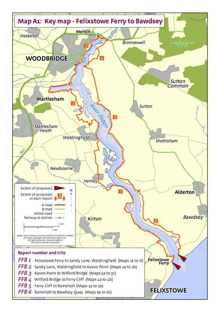
Secretary of State approves Felixstowe Ferry – Bawdsey Coastal Footpath route – 5 May 2024

On 5 May 2023 the Secretary of State for Environment, Food and Rural Affairs announced their decision to approve the Natural England (‘NE’) proposals for lengths FFB2 (Sandy Lane, Waldringfield to Kyson Point) and FFB3 (Kyson Point to Wilford Bridge).

Twelve months later (on 3 May 2024) they announced their decision to approve the NE proposals for lengths FFB1 (Felixstowe Ferry up river to Sandy Lane, Waldringfield), FFB4 (Wilford Bridge to Ferry Cliff), FFB5 (Ferry Cliff to Ramsholt) and FFB6 (Ramsholt to Bawdsey Quay).

https://www.gov.uk/government/publications/coastal-access-section-52-notice-for-felixstowe-ferry-to-bawdsey

DEFRA points out that “The right of access to the approved stretch of coast does not come into effect at this stage. Natural England will be working with the local authority to establish any infrastructure works before an Order is made by the Secretary of State under the 2009 Act to bring the rights into effect.”

EA ‘looking for sites to plant riverside trees’ – 30 April 2024

The Environment Agency today issued an invitation to local landowners and community organisations that could be of benefit to the River Deben. They say:

Tree planting along Rivers in Suffolk & north Essex 2024-5
We have some funding for native tree planting along rivers in Suffolk (including parts of Essex within
the River Stour catchment) for 2024-5 and wish to target those lengths of rivers which are likely to
benefit from additional trees and/or scrub.
Planting native tree species along a river can a significant improve water quality through stabilising
the riverbank and reducing sedimentation. Trees also provide much needed shade which helps to
keep rivers cool and improve the habitat for fish and terrestrial wildlife. Shading also helps to control
the growth of excessive emergent vegetation which can choke the channel slowing the flow and
causing siltation.
If you are interested, we would like to walk your stretch of river and discuss options with you. If
appropriate we will come up with some sympathetic planting proposals for your approval. The
funding will cover the material cost of trees and protection and planting costs. The timescales for
planting will need to be between November 2024 and March 2025 so we would aim to walk each
site and draw up any plans during summer and early autumn 2024.

Please click on this link to see the full invitation and contact details